Unmatched precision, elevated perspectives. Drone surveys, mapping, and data analysis for industries worldwide
At Sky Revolutions, we specialise in providing cutting-edge aerial imaging services designed to deliver accurate, efficient, and cost-effective solutions for various industries. Leveraging advanced drone technology and expert analysis, we offer a comprehensive range of services tailored to meet your specific needs.
Aerial imaging surveys capture high-resolution images and data from above. This innovative approach allows for detailed visualisation of large areas, structures, or views from above, eliminating the need for traditional ground-based inspections or scaffolding.
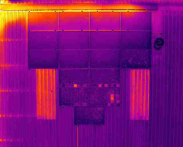
Equipped with advanced technologies such as high-definition cameras and thermal sensors, drones deliver precise and actionable insights tailored to various industries.
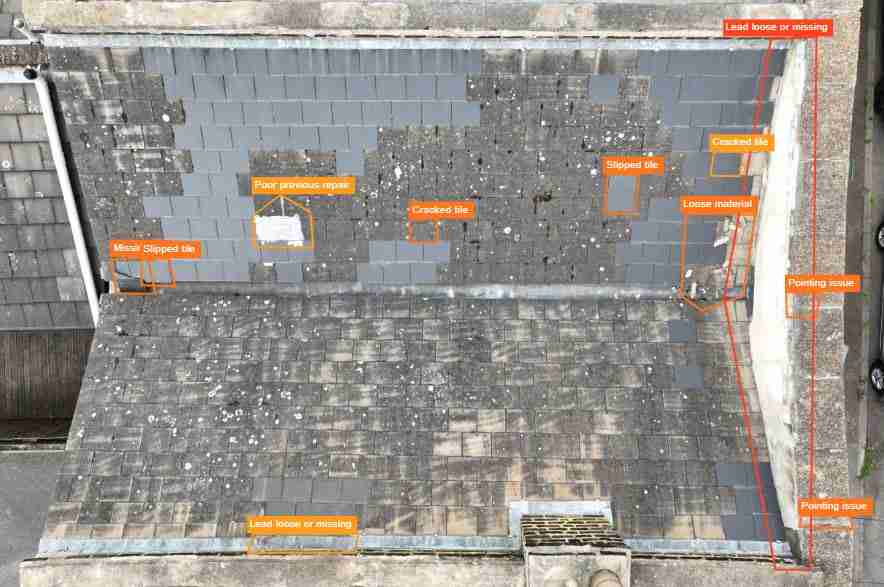
We offer comprehensive condition surveys using a combination of aerial and ground-based technology to capture high-quality data and imagery.
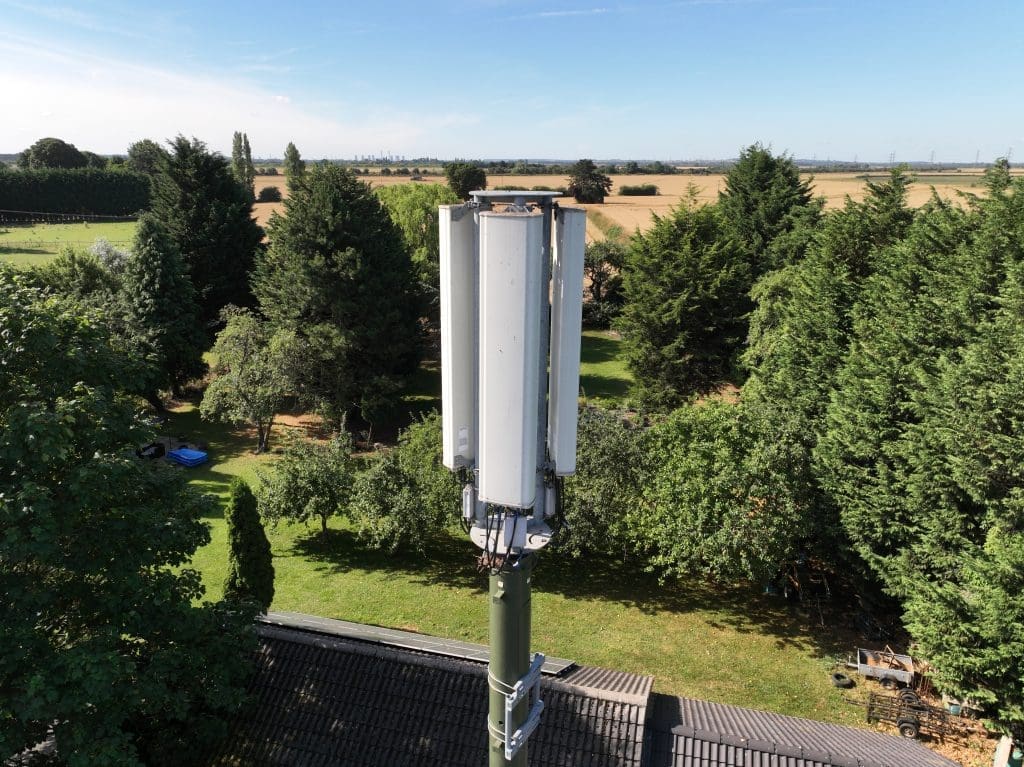
Our telecoms surveys provide essential support for the planning, installation, and maintenance of telecommunications infrastructure.
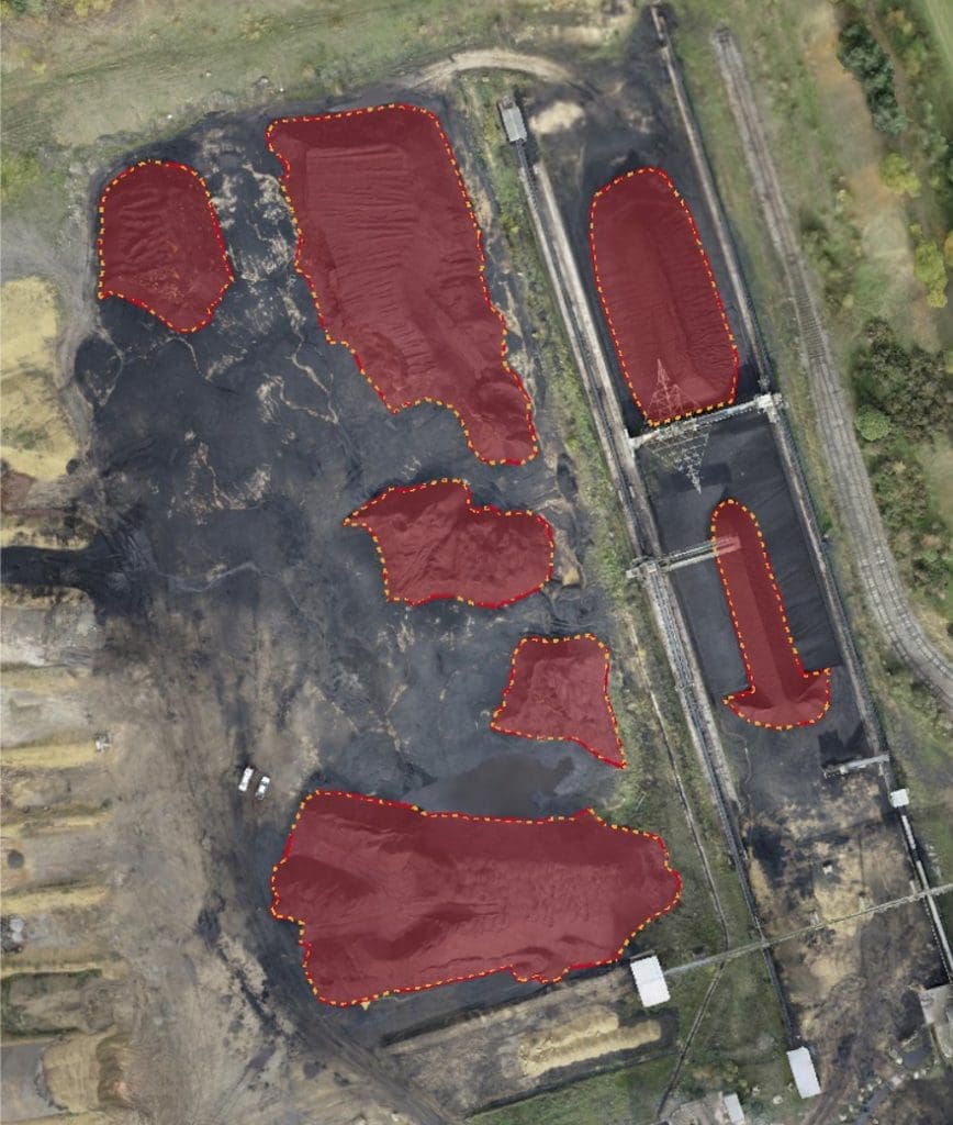
Efficiently measure and calculate volumes of stockpiles or excavations using advanced survey technology.


Our team will work with you to fully understand your project requirements and help you to develop the very best solution. We’ll meticulously plan every job to ensure that we get it right first time, every time.
Get in touch with us today to discuss your project. You can either contact us using this form and one of the team will get in touch shortly, or you can call the office directly on 01778 560929.